SQL 語法宣方式:
geometry::STGeomFromText('POINT('+ @X +' '+ @Y +')', 4326)
加入 Parameters 的方式
db.Parameters.Add("@X", SqlDbType.VarChar, X);
db.Parameters.Add("@Y", SqlDbType.VarChar, Y);
   using Microsoft.Security.Application;

   String APPLY_ID = Encoder.HtmlEncode((Request.QueryString["ID"]) ?? "");


   String iHTML = @"<table class='TableStyle01_cont'>
                                <tr bgcolor='#E8E8FF' align='center'>
                                    <th>項次</th>
                                    <th>名稱</th>
                                    <th>資料庫名稱</th>
                                </tr>
                    </table>";


   Literal1.Text = Encoder.HtmlEncode(iHTML);
      // Earlier = -1,
      // Later = 1,
      // TheSame = 0

     DateTime EXPIRE_END_DATE = DateTime.Parse("2019-10-14 01:00:00");
     if (EXPIRE_END_DATE.CompareTo(DateTime.Now) < 0 )
     {
             // "已過期!!"

     }else if (EXPIRE_END_DATE.CompareTo(DateTime.Now) == 0 )
     {
             // "日期時間一樣"

     }else if (EXPIRE_END_DATE.CompareTo(DateTime.Now) > 0 )
     {
             // "未過期!!"

     }
SqlConnection conn = new SqlConnection(ConfigurationManager.ConnectionStrings["DBConnStr"].ConnectionString);以下是解決方法:
 |
| 滑鼠右鍵,加入參考 |
 |
| 搜尋「system.configuration」 |
 |
| 出現在參考的清單裡 |
        using Geolocation;


        List points = new List();
        Coordinate coordinate = new Coordinate();

        coordinate.Latitude = 38.5;
        coordinate.Longitude = -120.2;
        points.Add(coordinate);


        Response.Write("38.5 -120.2 ->" + Encode(points) + "
");
    //解密
    public static List Decodee(string polylineString)
    {
        List list = new List();
        var polylineChars = polylineString.ToCharArray();
        var index = 0;
        var currentLat = 0;
        var currentLng = 0;

        while (index < polylineChars.Length)
        {
            var sum = 0;
            var shifter = 0;
            int nextFiveBits;
            do
            {
                nextFiveBits = polylineChars[index++] - 63;
                sum |= (nextFiveBits & 31) << shifter;
                shifter += 5;
            } while (nextFiveBits >= 32 && index < polylineChars.Length);

            if (index >= polylineChars.Length)
                break;

            currentLat += (sum & 1) == 1 ? ~(sum >> 1) : (sum >> 1);

            sum = 0;
            shifter = 0;
            do
            {
                nextFiveBits = polylineChars[index++] - 63;
                sum |= (nextFiveBits & 31) << shifter;
                shifter += 5;
            } while (nextFiveBits >= 32 && index < polylineChars.Length);

            if (index >= polylineChars.Length && nextFiveBits >= 32)
                break;

            currentLng += (sum & 1) == 1 ? ~(sum >> 1) : (sum >> 1);

            Coordinate coordinate = new Coordinate();
            coordinate.Latitude = Convert.ToDouble(currentLat) / 1E5;
            coordinate.Longitude = Convert.ToDouble(currentLng) / 1E5;
            list.Add(coordinate);
        }

        return list;
    }

    //加密
    public static string Encode(List points)
    {
        var str = new StringBuilder();

        var encodeDiff = (Action)(diff => {
            int shifted = diff << 1;
            if (diff < 0)
                shifted = ~shifted;
            int rem = shifted;
            while (rem >= 0x20)
            {
                str.Append((char)((0x20 | (rem & 0x1f)) + 63));
                rem >>= 5;
            }
            str.Append((char)(rem + 63));
        });

        int lastLat = 0;
        int lastLng = 0;
        foreach (var point in points)
        {
            int lat = (int)Math.Round(point.Latitude * 1E5);
            int lng = (int)Math.Round(point.Longitude * 1E5);
            encodeDiff(lat - lastLat);
            encodeDiff(lng - lastLng);
            lastLat = lat;
            lastLng = lng;
        }
        return str.ToString();
    }
比對後結果,感覺,Google Map Platform 網頁上第二和三筆是有問題的,不知道為什麼?

    using MySql.Data.MySqlClient;
    using System.Data;


    DataTable dt = new DataTable();
    MySqlConnection conn = new MySqlConnection(System.Configuration.ConfigurationManager.ConnectionStrings["MISConnection"].ConnectionString);
    conn.Open();

          using (MySqlCommand cmd = new MySqlCommand())
          {
               string CmdText = @"select * from basic where PK=@PK";

               cmd.Parameters.AddWithValue("@PK", PK);
               cmd.Connection = conn;
               cmd.CommandText = CmdText;

               MySqlDataReader myData = cmd.ExecuteReader();

               if (myData.HasRows)
               {
                    dt.Load(myData);
               }
          }

    conn.Close();
      using System.Data;
      using System.Data.SqlClient;

      SqlConnection cn = new SqlConnection(System.Configuration.ConfigurationManager.ConnectionStrings["DBConnStr"].ConnectionString);
      cn.Open();
      String PK = "1";
      DataTable dt = new DataTable();

      string _sql = @"select * from basic where PK=@PK";
      using (SqlCommand cmd = new SqlCommand(_sql, cn))
      {
           cmd.Parameters.Clear();
           cmd.Parameters.AddWithValue("@PK", PK);
           //cmd.ExecuteNonQuery();
           using (SqlDataAdapter da = new SqlDataAdapter(cmd))
           {
               dt.BeginLoadData();
               da.Fill(dt);
           }

      }

        cn.Close();
    DataTable dt = new DataTable();
    string filename = Server.MapPath(@"test.xls");
    dt = ConvertExcelToDataTable(filename);

    public static DataTable ConvertExcelToDataTable(string FileName)
    {
        System.Data.DataTable dtResult = null;
        int totalSheet = 0; //No of sheets on excel file
        using (OleDbConnection objConn = new OleDbConnection(@"Provider=Microsoft.ACE.OLEDB.12.0;Data Source=" + FileName + ";Extended Properties='Excel 12.0 Xml;HDR=YES;IMEX=1;';"))
        {
            objConn.Open();
            OleDbCommand cmd = new OleDbCommand();
            OleDbDataAdapter oleda = new OleDbDataAdapter();
            DataSet ds = new DataSet();
            System.Data.DataTable dt = objConn.GetOleDbSchemaTable(OleDbSchemaGuid.Tables, null);
            string sheetName = string.Empty;
            if (dt != null)
            {
                var tempDataTable = (from dataRow in dt.AsEnumerable()
                                     where !dataRow["TABLE_NAME"].ToString().Contains("FilterDatabase")
                                     select dataRow).CopyToDataTable();
                dt = tempDataTable;
                totalSheet = dt.Rows.Count;
                sheetName = dt.Rows[0]["TABLE_NAME"].ToString();
            }
            cmd.Connection = objConn;
            cmd.CommandType = CommandType.Text;
            cmd.CommandText = "SELECT * FROM [" + sheetName + "]";
            oleda = new OleDbDataAdapter(cmd);
            oleda.Fill(ds, "excelData");
            dtResult = ds.Tables["excelData"];
            objConn.Close();
            return dtResult; //Returning Dattable
        }
    }


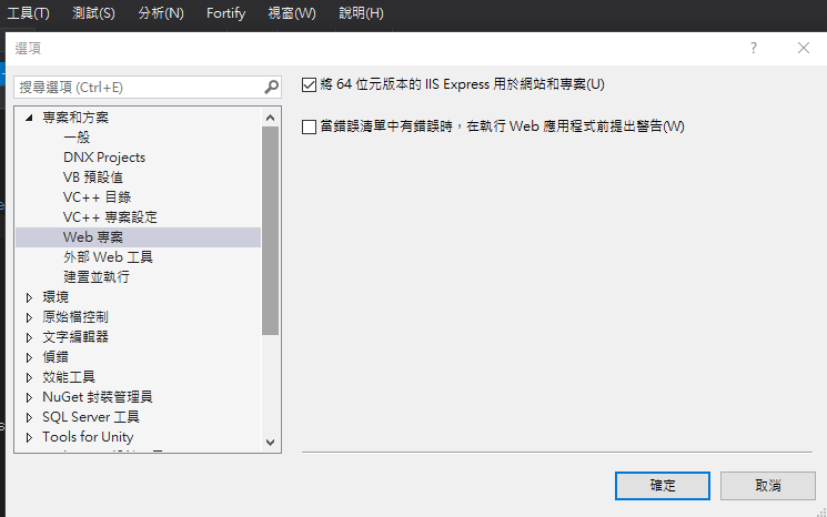
 |
| 圖1 |


function createXMLHttpRequest() {
     try { return new XMLHttpRequest(); } catch (e) { }
     try { return new ActiveXObject("Msxml2.XMLHTTP"); } catch (e) { }
     try { return new ActiveXObject("Microsoft.XMLHTTP"); } catch (e) { }
           alert("XMLHttpRequest not supported");
         return null;
}


var xmlHttpReq = createXMLHttpRequest();
xmlHttpReq.open("GET", "http://...網址?CIDS="+pics, false);
xmlHttpReq.send(null);
if (xmlHttpReq.responseText == "1")
{

}
==================== ashx ======================= using System;
using System.Web;
public class SaveReleasePic : IHttpHandler {
public void ProcessRequest (HttpContext context) {
            context.Response.ContentType = "text/plain";
            context.Response.Write("1");

    }

    public bool IsReusable {
        get {
            return false;
        }
    }

}


